

A Transit Proposal for Toronto - the Don Line.
A Transit Proposal for Toronto - the Don Line.
This transit line has massive potential ridership, we just need to plan for it.

I’ve never really tried to propose a fairly detailed transit line — so here goes nothing. But before getting into the proposal, let’s first take a look at some background…
Background
Whenever I talk about GO Transit’s massive regional transit expansion program, one of the most frequent questions I get goes something like this:
“So Metrolinx owns the Richmond Hill line, why aren’t they upgrading it?”
This is a very good question, and historically I’ve sort of dismissed such a program of works for a few reasons:
The line is very curvy and this limits it potential speed.
The line is poorly aligned to connect with other transit at Bloor or Eglinton.
As Metrolinx frequently points out, the Richmond Hill line suffers from high flood risk, particularly at its southern end.
But, at the same time, Metrolinx — at least at one point — was considering electrifying a small segment of the Richmond Hill line, and plans are still present to reactivate a short portion of the Don branch next to the Don Valley Parkway to store some trains during midday periods — which has drawn some significant negative attention. While I don’t really think reactivating a portion of rail line next to an urban freeway should be seen as such an environmental negative, this does seem unnecessary for the storage of just three trains.
Nonetheless, the fact that Metrolinx is willing to spend any money on the Richmond Hill line is a good reminder that this is an asset they (and by extension the Ontario public!) own a large portion of, and that we probably should be more thoughtful in seeing if there’s a way we can utilize it to enhance the regional public transport network — especially since the line is generally less than 5 kilometres east of the Yonge subway, which was on its way to moving the better part of a million people every single day pre-Covid.
Part of the point here is not to suggest we start doing major infrastructure works on the Richmond Hill line tomorrow, but rather to suggest that we include it in our long term plans as a line we would like to substantially enhance.
One of the biggest places where Toronto (and a lot of cities around the world, for that matter) get into trouble is by not planning transit long in advance. This makes it difficult to shape our land use and intensification around transit to ensure it’s good from day one, and also so that people can have good transit service when they move into a new neighbourhood. At the same time, one of the biggest barriers to a well integrated and cost effective rapid transit network are the type of major barriers like other transport infrastructure, major sewers, and other utilities that we should generally try to keep clear of places we might want to build stuff in the future! Basically — planning ahead can let us not get in our own way in a way we so often do.
Now, before I get into a detailed breakdown of what I would propose for a new transit line that makes use of the Richmond Hill corridor, let me address the concerns I highlighted previously:
The line is very curvy and this limits it potential speed.
The line is poorly aligned to connect with other transit at Bloor or Eglinton.
As Metrolinx frequently points out, the Richmond Hill line suffers from high flood risk, particularly at its southern end.
The first two issues can be solved by not only using the Richmond Hill line but also other connected rail corridors, and the second is less of an issue than I think we make it out to be. We are spending significant sums of money to reduce flood risks along the Don River, and at the same time there are other interventions we can take to harden the Richmond Hill line such as flood walls. We are currently putting a lot of future rail infrastructure and service along the existing rail bridge that carries the Lakeshore East and Stouffville lines across the Don (as well as the Ontario Line in the future, so there is already going to be lots of reason for future flood and stormwater management along the Don. If need be, the riskiest portion of the Richmond Hill line that runs along the Don and under a number of east-west road bridges could be elevated, which could also allow the return of a slightly more natural and human friendly west riverbank ,with a greenway similar to what’s being built at the Davenport diamond.

Proposal
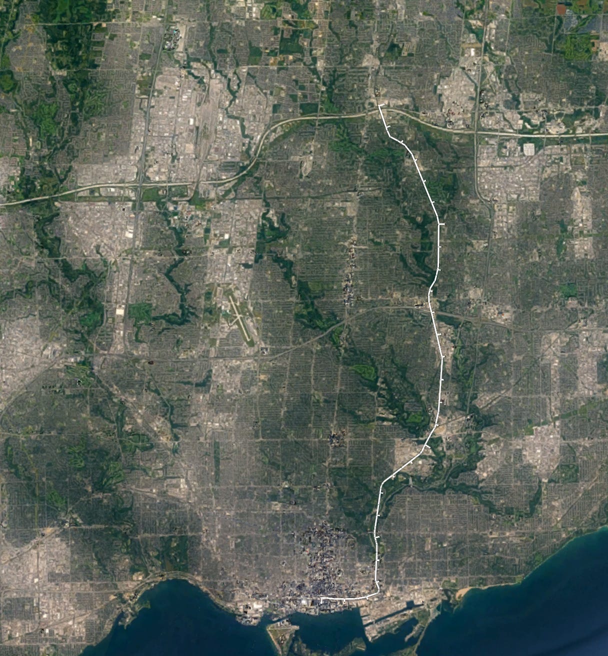
My proposal would begin at Richmond Hill Centre at its northernmost extent — Richmond Hill Centre has already seen significant densification, and the density planned around the Yonge Subway extension (south of Highway 407 in particular) alongside the large bus terminal are likely to exert some significant capacity pressures on Line 1 in the medium term.

Now, the portion of the Richmond Hill Line Metrolinx owns ends south of the CN York subdivision, so the northernmost bit of my proposed line would require working with CN to lay two additional tracks in their corridor as well as grade-separating these tracks, probably in a trench.
I would probably put the first station to the south at Steeles Avenue. This lets us intercept riders from the busy Steeles East bus, although space is a bit of a constraint here.
A new station at Steeles would probably lead to the removal of Old Cummer station (what a loss), but given the latter’s location in a hydro corridor, it was never that great of a site for TOD, and while Old Cummer did provide a connection to Finch Avenue — it wasn’t great.
[Old Cummer station]
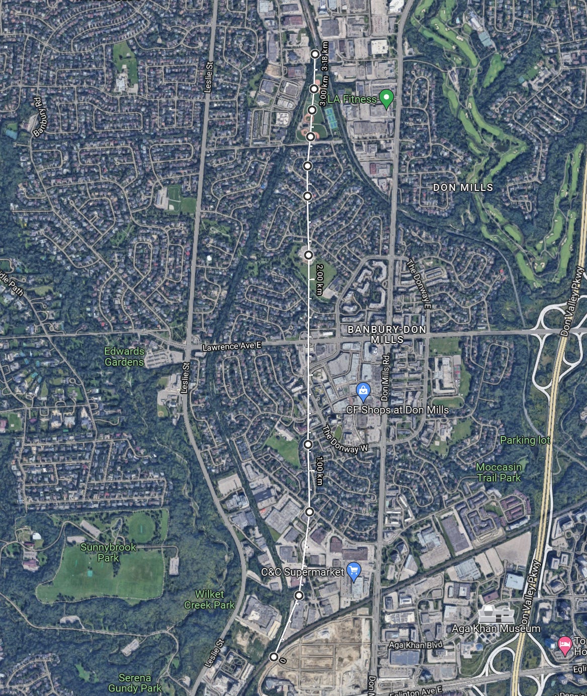
Our next station Leslie is also only a few kilometres to the south. As part of any major transit expansion on the Richmond Hill corridor, I would recommend moving Oriole (the current name of the GO Station) up to be directly adjacent to Leslie, which allows for a better subway transfer (the Leslie bus terminal directly abuts the tracks) and also gets the station closer to Sheppard Avenue and most of the surrounding development.
If it wasn’t already clear, I’d want to entirely double track the Richmond Hill corridor as part of this project, and for the most part that appears fairly trivial: there’s lots of space in the corridor. However, there are already two fairly major bridges south of Steeles — one over Duncan Woods creek and another over the Don River. Duplicating these would be a more significant hurdle.
Continuing south from Leslie, the line would pass under the 401 and run through a light industrial area, where land could potentially be bought up for a combined maintenance facility/station/transit-oriented development (on a deck akin to projects in Hong Kong) — although this isn’t strictly necessary.
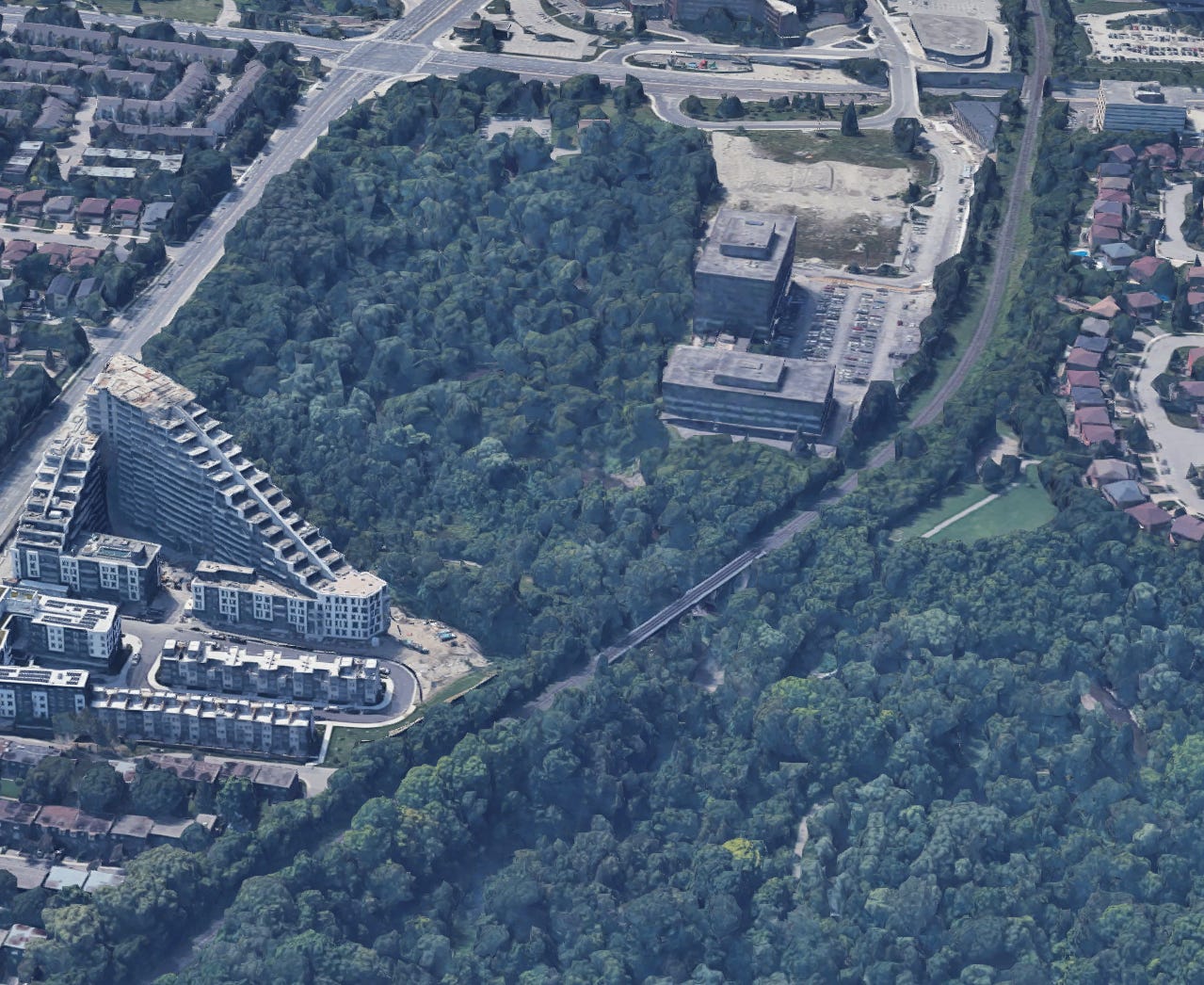
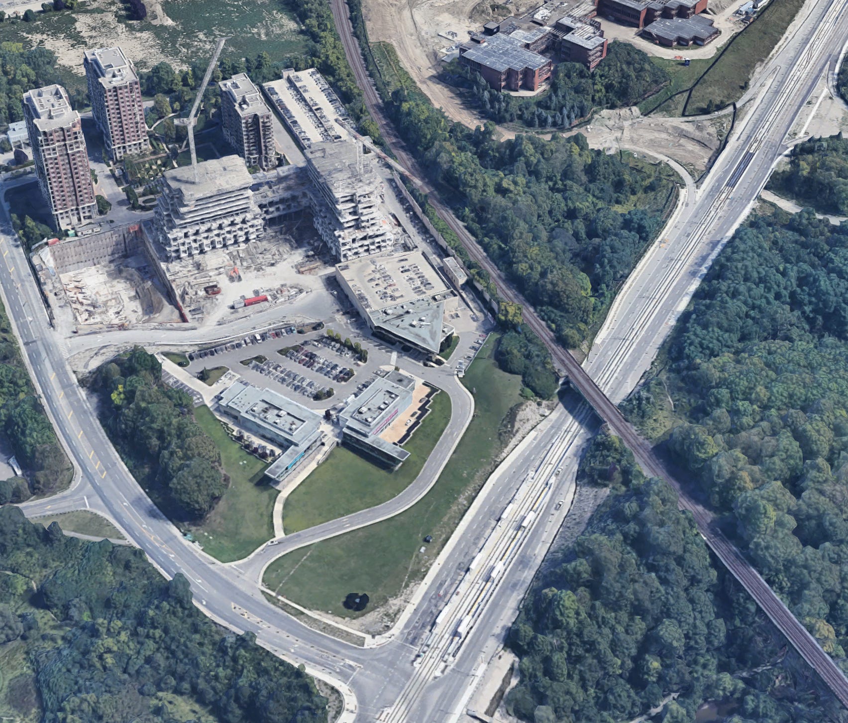
From here, things get more interesting. Instead of following the current Richmond Hill line alignment, we would divert onto the former Leaside Spur right of way, currently being used as a rail trail. Now, I am aware that the idea of converting a former rail alignment back into rail use from trail use is likely to garner substantial pushback, so we do have some options here:
Turn the current trail into a trench to provide full grade separation — there is likely enough room for a trail to be maintained, but if not, land could be bought up from adjacent homes with those homes getting direct access onto a nicely landscaped new greenway. A station could be built at Lawrence Avenue, which would provide good access to the Edwards Gardens as well as the Shops at Don Mills and a natural terminating point for the busy Lawrence bus.
Assuming the local community is completely opposed to new nearby rapid transit, a tunnel could be utilized as a last resort. This might actually not be necessary, because I expect the tides will continue to move in a direction where transit is more popular. In this case, a roughly 3-kilometre tunnel would be built starting from around Kern road. If the community was willing to allow this tunnel to be built cut-and-cover along the existing pathway, they could be compensated through a very nicely designed enhanced greenway built on top — otherwise a more direct tunnel bore directly south could be used. In both cases, a Lawrence station probably would be too expensive to make sense.
Continuing south out of the tunnel, we pretty immediately arrive at Eglinton Avenue, on the west of the soon to be fully of super high density housing Celestica site. I’d put a station across Eglinton, here which would serve the adjacent parks as well as the significant adjacent development, and which could connect fairly well with the Line 5 Sunnybrook Park stop, although this would be a tricky connection as I would align the passenger rail tracks to the southeast of the CP midtown line.
From Eglinton, we would continue along the CP line to another station site at Thorncliffe park adjacent to the Ontario Line maintenance facility. This station would be connected via an overhead bridge to the new Ontario Line station, and would provide more connectivity to the neighbourhood in addition to the Ontario Line.
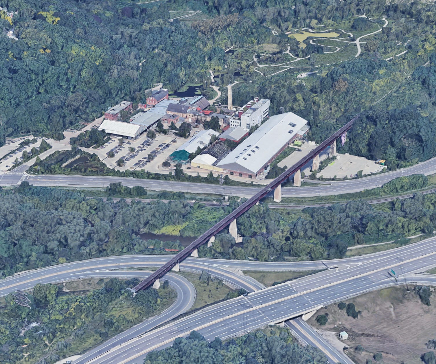
Continuing south, our line would turn away from the CP Midtown line onto the Don Branch, which would mean bringing an old alignment back into use. This would require some serious rebuilding, but should be simpler than building an entirely new alignment.

This part of the alignment would require the biggest rehab of the entire project — either retrofitting and duplicating the existing but unused bridge over the Don Valley near the evergreen brick works, or replacing it with a new double tracked bridge.
South of the crossing of the valley, the rail alignment would continue alongside the Don Valley parkway, tying into and replacing the Metrolinx storage facility being built around the Prince Edward viaduct. A station could and should be built here to connect with Line 2. It would be complicated, but Montreal figured out how to build a new station on the Mount Royal tunnel inside of a mountain 80-metres below the surface, so I’m sure we can figure something out. Having this connection to Line 2 would be good for connectivity as well as for additional Bloor-Yonge and Line 1 relief. A connection would most likely be a long tunnel from the western end of the platforms at Broadview (with moving sidewalks if distances are long enough) and then a series of escalators — probably in a new structure built over the Don valley platforms.
From here, the line would follow the tracks back across the Don River to connect to the southernmost portion of the current Richmond Hill GO Line. Just south of Gerrard and north of Dundas I would place another station (which I think Metrolinx should do even if a proposal like mine is never built), which could be served by trains using the Richmond Hill line to terminate and turn around. This station would serve Regent Park, and could intercept riders from the College and Dundas streetcars while also providing rapid transit access to a neighbourhood that does not currently have it.
The last station I would build would lie just south of Eastern avenue with the southern end of the platform being just near the rail line’s curve to the west. These platforms would serve the Canary District, and would be connected directly to East Harbour via a wide 200 meter bridge over the Don. This would be great for a few reasons: it would further enhance the hub status of East Harbour, it would provide for much better connections between the Richmond Hill corridor and the Eastern GO lines, and it would make use of the fact that trains need to slow anyways to travel through the curve onto the Union Station rail corridor.
Speaking of the Union Station rail corridor, it makes sense to add a few additional stations along it to be served by our services — if we haven’t added them already by the time construction starts. East of Union the USRC already has 6 tracks, which is enough for 2 per eastern rail line as well as room to spare for station platforms. These stations would provide much enhanced connectivity to downtown east, the eastern waterfront (which is growing like crazy), and relief to Union itself.
Taking a high level view, the alignment I’ve suggested — which I would name the Don line thanks to its many crossings and route along the valley — would be a serious enhancement over the current GO Richmond Hill line, avoiding the most flood-prone and winding parts, while also being better located to connect to Line 2, 3 (Ontario Line) and 5. The much straighter alignment and >2km average station spacing should also allow very high line speeds, which would make many trips faster on the Don Line when compared to Line 1 and 3.
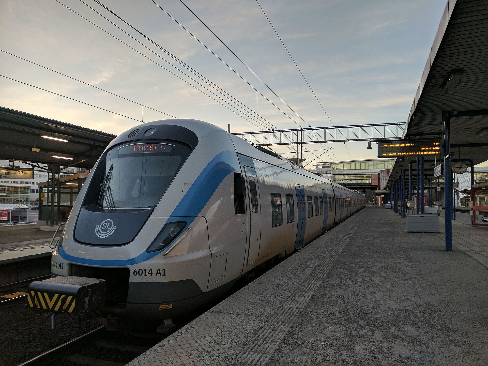
Train service on the Don Line would be high frequency — at least every 7 minutes to start, and supported by modern signalling and the fully grade separated alignment. Trains would be low floor as to be inter-compatible with the regional rail network, but would explicitly be single level emus. Such trains would be necessary to minimize the size of the potential tunnels near Lawrence Avenue, as well as for better performance and capacity with high frequency service. Something like the SL X60 used in Stockholm would work nicely for this.
I have avoided mentioning GO too much when talking about the proposed service because it would look nothing like today’s GO transit service, or even near future electric regional rail in Toronto, as EMUs and super high frequency service would be a day 1 expectation. Trains would be 8 - 10 cars long, meaning that the line would have substantially more capacity than Line 1 in the long term.
Why does this project make sense?
The natural question with a proposal of this scale is… why?
For one, Yonge Subway and Ontario line congestion will be a problem again in the future, and if demand for transit and urban living increases as much as I expect it to because of demographic, climate, and affordability trends, then demand for more capacity as well as faster journeys will likely be something we need to address in the next few decades. Providing both additional speed and capacity should draw riders off of Lines 1 and 3, which both have connections along the Don Line — freeing up for capacity for riders travelling to destinations directly along those lines. The connectivity would also be strong to other lines such as Line 4, the VIVA BRT network, the 407 GO corridor, the waterfront streetcar network, as well as GO services.
At the same time, as we grow larger and execute a number of very expensive transit projects like the Ontario Line, and GO Electrification, I expect the days of nearly limitless transit capital funding will not last. The Don Line provides roughly 2x the capacity of the Ontario Line with at most 3 kilometres of new tunneling (Ontario Line will be closer to 10 kilometres) and no new underground stations. Most of the works are in double tracking, select grade separations, bridges duplication and retrofitting, and new and rebuilt above ground stations.
The Don Line would also be great for social equity and new housing: It would serve several neighbourhood improvement areas and portions of the line running near current light industrial land could be used to construct significant new housing.
All in all, this is a plan I would love to see Toronto execute!
This is very interesting and I like it a lot. As a Southern Ontarian who’s been living in Germany for the last 11 years, I’ve loved having excellent public transportation and wholeheartedly agree with the idea of building capacity now for ridership later, especially as Toronto is already playing catch-up here.
I’m curious if you have any cost estimates to build this line? I assume it would be quite efficient to use existing rights of way and not tunnel everywhere, and it would be interesting to see how that would translate into actual numbers. I know it’s a big ask, but even an upper or lower bound estimate or order of magnitude (i.e. 100s of millions, billions, 10s of billions, etc) would be very interesting to hear.
Thanks again for your great work spreading the word about transit! I’ve soaked up your YouTube videos and Substack over the past several months and learned so much.
I think part of the hurdle in doing something logical like this may be just in the classification of this sort of transit line compared to the existing arrangement in GT(H)A. As you point out, it's not typical GO, and it's certainly not TTC. It's more akin to a Toronto version of the London Overground in terms of route, frequency, capacity and interchanges. I think it's a great solution that meets a lot of needs, but just getting people into that headspace might be the overwhelming challenge.